Somewhat conjectural1
Somewhat conjectural1
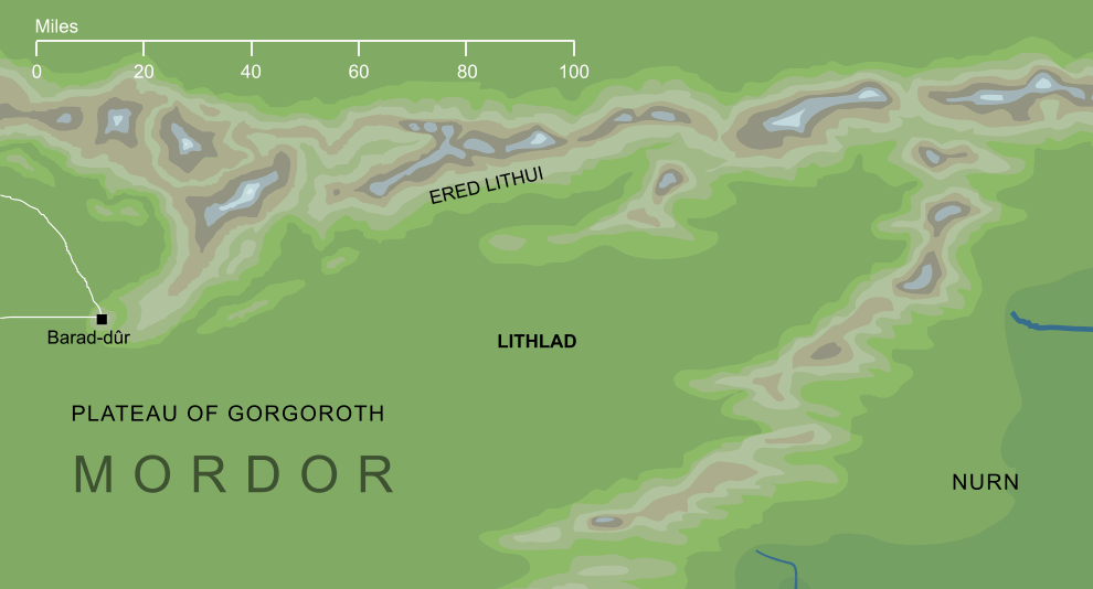
A plain that lay in the north and east of Mordor, connected to the Plateau of Gorgoroth. The name Lithlad means 'plain of ash', suggesting that it was strewn with the ashes of the Fire-mountain Orodruin that lay to its west (though the name may also be connected to Ered Lithui, the Ashen Mountains that formed Lithlad's northern border). The precise location and dimensions of Lithlad are rather indefinite, though we know that it lay to the east of Barad-dûr, and it seems to have represented the eastern parts of Mordor's northern plateau, above the point where that land descended into the more fertile lowlands of Nurn.
Notes
1 |
The plain of Lithlad is mentioned in the text of The Lord of the Rings, but it does not appear on any of the maps included in that book. It is shown on a much earlier map of Mordor reproduced in volume VII of The History of Middle-earth, and the location shown above is based on that map. From that source, we can be sure that it lay on the southern side of Ered Lithui to the east of the Barad-dûr, but its distance from the Dark Tower is open to some question. On the old map, the geography of Mordor is rather more condensed than it later became, and Lithlad is shown east of both Barad-dûr and the source of Mordor's northern river, which were at that time relatively close together. On the final maps they're much further apart, with the river now so close to Mordor's eastern borders that it seems to make little sense for Lithlad to lie beyond it. For that reason, the map above takes the name Lithlad to refer to the relatively well defined 'bay' in the mountains northeast of Gorgoroth, though this is arguably open to interpretation.
|
Indexes:
About this entry:
- Updated 17 June 2014
- This entry is complete
For acknowledgements and references, see the Disclaimer & Bibliography page.
Original content © copyright Mark Fisher 2002, 2010, 2014. All rights reserved. For conditions of reuse, see the Site FAQ.
Website services kindly sponsored by myDISCprofile, the free online personality test.
How do your personal strengths fit in with career matching? How can you identify them? Try a free personality test from myDISCprofile.