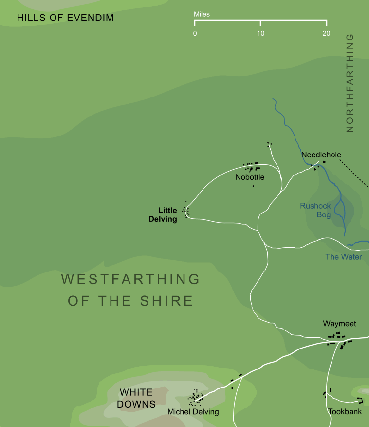
A village or small town in the Westfarthing of the Shire. It was related, at least by name, to Michel Delving (that is, 'Great Delving') on the White Downs.3 Its precise location is unknown, but it stood some miles to the north of Michel Delving, and was connected by road to Nobottle and to Waymeet.
Notes
1 |
The 'little' in the name of this township is in reference to Michel (or 'great') Delving to the south. The two towns were evidently related in their earlier history, though Michel Delving grew to become the chief settlement of the Shire, while Little Delving remained relatively obscure.
|
2 |
We have no detailed map showing the location of Little Delving. The small-scale map of the Shire in The Lord of the Rings ends rather inconveniently to the west of Waymeet, leaving us with a westward-pointing arrow marked 'To Little Delving'. Given its association with Michel Delving to the south, the geography of the village of Little Delving was doubtless similar to that shown here, but the details of its location and layout are not known with certainty.
|
3 |
The shared name 'Delving' seems to imply that Little Delving was cut into the White Downs, like Michel Delving to the south. This does not seem consistent with the map we have of this region, in which the White Downs run southward of the East Road, while Little Delving stands somewhere to its north. It is possible that the White Downs ran farther north than shown on the large-scale map, or that a smaller range of lower hills could be found in this area, not shown on any map.
|
Indexes:
About this entry:
- Updated 1 April 2016
- This entry is complete
For acknowledgements and references, see the Disclaimer & Bibliography page.
Original content © copyright Mark Fisher 1999, 2001, 2015-2016. All rights reserved. For conditions of reuse, see the Site FAQ.