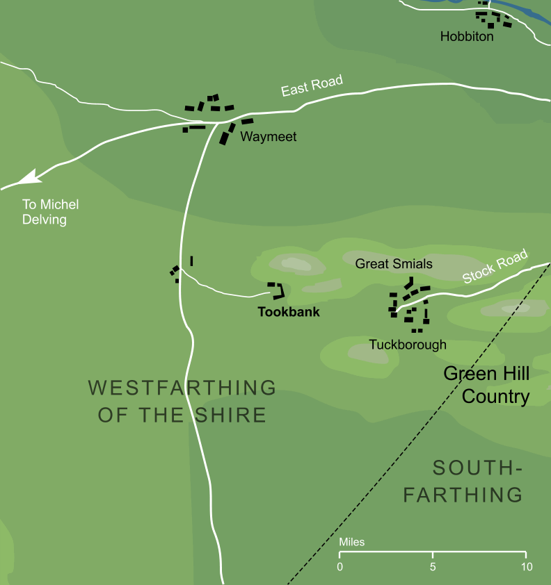
The smaller of the two main settlements of the Tookland, about seven miles to the west of Tuckborough, which was the larger of the two towns in the region. The name 'Tookbank' is clearly derived from the Tooks, in whose folkland it lay, combined with the word 'bank', meaning 'hillside'.
Tookbank is geographically curious in that it does not appear to have been connected by road with its much larger neighbouring town of Tuckborough - indeed the only overland access to Tuckborough would involve a significant detour2 through Stock, far to the east. The Tooks may have made this arrangement intentionally, so that traders or other visitors to the Tookland would do their business through Tookbank and thus avoid their main township. Alternatively, it may be that the two villages were in fact connected, but by tunnel rather than by road; a seven-mile underground passage seems rather implausible, but was perhaps not beyond the renowned tunnelling capabilities of the Hobbits.3
Notes
1 |
Tookbank, and the Tookland generally, must have been settled after the Shire was founded in III 1601. Given that the region was more than fifty miles westward of the Brandywine Bridge, it probably took some time before the village was settled. We do know that the Tooks were a well established family by III 2340, when Isumbras I became the first Took Thain, so it seems fair to assume that Tookbank would have existed by that date (and probably for some time beforehand). |
2 |
To call the detour 'significant' is perhaps an understatement. For example, Hobbiton was less than twenty miles from Tuckborough as the crow flies, but to travel between the two towns by road would have involved a trip of some forty miles east to the Brandywine Bridge, about ten miles south to Stock, and then another fifty or so miles back westward to the final destination of Tuckborough.
|
3 |
This is all based on the detailed map of the Shire included with The Lord of the Rings, which shows no road between the two towns. Of course, an obvious third possibility is that a road or track did exist, but was simply omitted from the map.
|
Indexes:
About this entry:
- Updated 29 July 2016
- This entry is complete
For acknowledgements and references, see the Disclaimer & Bibliography page.
Original content © copyright Mark Fisher 1998, 2001, 2012, 2016. All rights reserved. For conditions of reuse, see the Site FAQ.