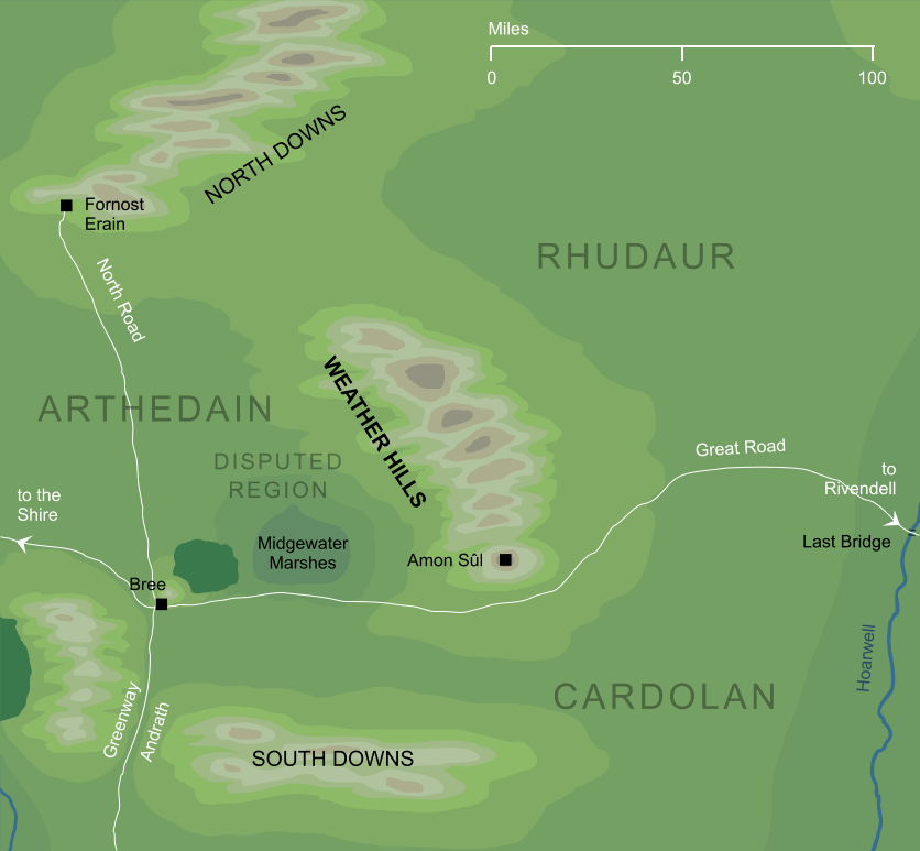
The name among Men for the north-south range of hills that lay in central Eriador, and in ancient times marked part of the border between the lands of Arthedain and Rhudaur. Weathertop, or Amon Sûl, lay at the southern end of the range.
Notes
1 |
The hill at the southern end of this range was known in Elvish as Amon Sûl, which literally meant 'hill of the wind', but was translated as 'Weathertop'. If the same convention holds for the entire range of the Weather Hills, then their name implied that they were the 'windy hills', which would make perfect sense for an isolated range running through a flat surrounding land. On this association, we would expect the hills to have a Sindarin name something like Emyn Suil, though in fact we do not have a canonical Elvish name for the Weather Hills as a range.
|
See also...
Amlaith of Fornost, Amon Sûl, Angmar, Argeleb I, Cardolan, Frodo Baggins, King of Arthedain, Kingdoms of the Dúnedain, Midgewater Marshes, Mount Gram, Prince of Cardolan, Weathertop, Witch-realm of Angmar
Indexes:
About this entry:
- Updated 27 August 2016
- Updates planned: 1
For acknowledgements and references, see the Disclaimer & Bibliography page.
Original content © copyright Mark Fisher 1998, 2001, 2016. All rights reserved. For conditions of reuse, see the Site FAQ.