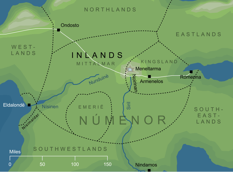
The central region of Númenor, known as the Mittalmar to the inhabitants of that island realm. The Inlands were very approximately circular in shape, and had no shoreline except in the extreme east, where the port city of Rómenna stood on an inlet between the Orrostar and the Hyarrostar. In the centre of this region stood the Meneltarma, Númenor'sHoly Mountain, and from a valley at its feet sprang the Siril, the greatest river of the island, which flowed southward through the Inlands.
The eastern quadrant of the Mittalmar was taken up by a region known as Arandor, the Kingsland, in which stood both Rómenna and the royal city of Armenelos. Outside this busy area, the Inlands were mainly a region of treeless grassland used for pasture. In the southwest lay a downland known as Emerië, where the White House of Erendis stood.