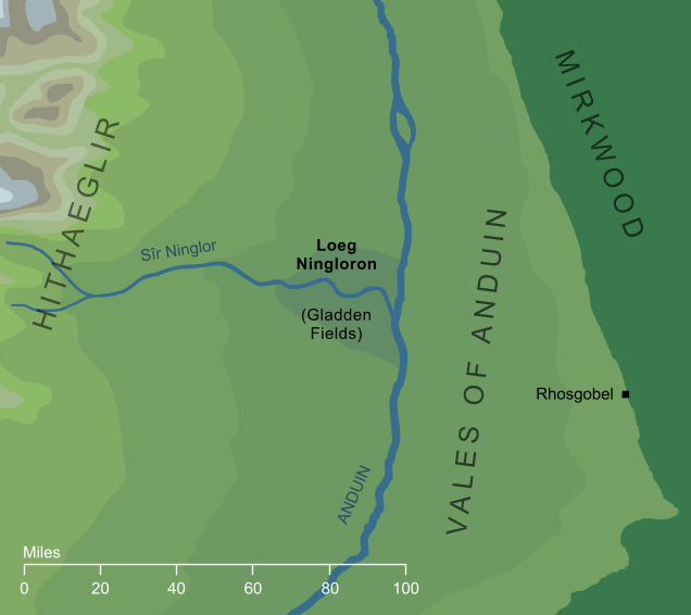
The region where the Gladden River flowed down from the Misty Mountains to meet the Great River Anduin, south of the Carrock. In ancient times, a lake had formed at their meeting-place, but by the beginning of the Third Age the lake had been replaced by a land of marshes and islets. These were the Gladden Fields (named from the giant yellow iris flowers that grew there in hosts). In Elvish, the Gladden River was known as Sîr Ninglor, from which derived the Elvish name for the Fields: Loeg Ningloron.
In the first years of the Third Age, after the first defeat of Sauron, Isildur was marching close to the Loeg Ningloron when he was set upon by a host of Orcs. His soldiers were overwhelmed, and he escaped into the wetlands only to be shot down by an Orc-arrow. There he was lost, and with him the One Ring that he was carrying north, which lay hidden in the marshes of Loeg Ningloron for nearly two and a half thousand years.
Notes
1 |
The word loeg is only seen as part of this name, and its meaning is not precisely known. The form appears to be plural (as we might expect from a word translated 'fields'), suggesting a singular log, though some sources suggest that loeg might actually have been a singular. All available evidence suggests that the translation is not completely literal, and that the Elvish original meant 'pools' or 'pool' rather than 'fields'. ('Fields' in this context would refer to the stretches of marsh in this open wetland.)
If loeg is difficult to interpret, Ningloron presents fewer difficulties. It comes from Ninglor, the Elvish name for the Gladden River, which literally meant 'goldwater'. The 'gold' here comes from the golden gladden lilies which grew in profusion along this river, and gave it its name in the Common Speech. The entire Elvish name Loeg Ningloron, then, would be literally as something like 'pools of the goldwater'.
|
Indexes:
About this entry:
- Updated 14 May 2023
- This entry is complete
For acknowledgements and references, see the Disclaimer & Bibliography page.
Original content © copyright Mark Fisher 2003, 2011, 2023. All rights reserved. For conditions of reuse, see the Site FAQ.